Showing posts with label big sur. Show all posts

Sunday, December 16, 2012

Over the Mountain ... (Part 7 of 7): Coming down and merging with the PCH

by Steve Reiss (Dalmdad Landscape Photography - www.dalmdad.com and https://www.facebook.com/Dalmdad.)

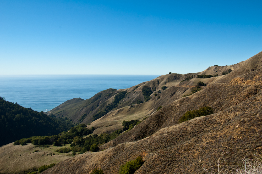
Nacimiento-Fergguson Road (NFR), heading down to the Pacific Ocean: The last bits of the NFR experience are downhill from the high-country of the Santa Lucia Range to sea level at the Pacific Ocean and the Pacific Coast Highway (PCH, CA-1) in rugged Big Sur country.


Views towards the Pacific Ocean from the high-country


**

Views of the coastal parks, as NFR winds its way down to sea level.


PCH heading north towards Carmel along Big Sur Coast


PCH heading south towards Cambria along Big Sur Coast

Looking down on PCH


**

When you reach the Pacific Ocean, you can either head south towards the Piedras Blancas Elephant Seal Preserve and Cambria or north towards Big Sur, Carmel, and Monterey.

A recommendation would to head south just a little bit to the town of Gorda, overlooking the Pacific Ocean.  A wonderful restaurant, the Whale Watcher Cafe, is waiting for you.


Though the Whale Watcher gets some pretty awful reviews at yelp, we never had a bad experience there.  Indeed, this was one of the first places we ate at when we drove cross-country for the first time.  Yes, the prices are steep, but this is a very remote location and we never left feeling we were extorted.  The burgers and the nachos are great and can be eaten while looking out for passing whales.

**

Sunday, December 9, 2012

Over the Mountain... (Part 6 of 7): Driving above the sea layer in the Santa Lucia Mountains

by Steve Reiss (Dalmdad Landscape Photography - www.dalmdad.com and https://www.facebook.com/Dalmdad.)

Nacimiento-Fergguson Road (NFR), high in Los Padres National Forest: After driving the dark, damp, forest floor, NFR begins its climb towards its summit at 2780 feet.  NFR is well paved and maintained, but is very winding and has precipitous drops at almost every turns.  There are no guard rails. The turn-off for Cone Peak Road, leads to some fantastic ocean sunsets.  However, Cone Peak Road may be closed due to weather from November to May.  The turn-off for Coast Ridge Trail, near the turn-off for Cone Peak Road, leads substantially parallel to the Pacific Ocean (i.e., north-south), along the crest of the range.

In October, 2009, the Mano Seca Group installed a bench near the top of the western slope of Nacimiento-Fergusson Road. A large turnout on the road provides easy parking; an opening in the roadside fence provides a path down to the bench.  The Mano Seca Group has a guerrilla reputation, as federal and state park services do not take kindly to the construction of unauthorized structures on park grounds.

Looking down one of the canyons from above the sea layer on NFR


Road cut for NFR clearly visible.


Road cut for NFR clearly visible.


Road cut for NFR clearly visible.


Road cut for NFR clearly visible as it circles the knob above the sea layer.


Burnt out trees contrasting with the high elevation greenery.


View across the Santa Lucia Range


Another view across the Santa Lucia Range


Road cut for NFR clearly visible along with the Pacific Ocean.

Saturday, October 27, 2012

Over the Mountains and Through the Woods, to the Pacific Ocean we go...

 by Steve Reiss (Dalmdad Landscape Photography - www.dalmdad.com and https://www.facebook.com/Dalmdad.)

There are approximately 33 "road miles" between the inland Monterey County, CA, near ghost-town of Jolon and the Pacific Coast Highway (CA-1).  Those 33 road miles twist and turn and cover a mere 20 "as the crow fly" miles.

The 33 road miles are in no way an easy drive.  The switch-backs and alternating gas and brake pedalling will tire you...and then you will still have the strenuous drive north along the Big Sur coast to wherever you are going to call it a day.  However, it is all worth it.

Included in the 33 miles are:

1) visiting the remnants of Jolon, once a thriving community.  Now, not so much;

2) visiting Fort Hunter Ligget, known for the herd of free-range tule elk that roam the fort grounds;

3) visiting Mission San Antonio and its parish desert tortoise, also on the fort grounds;

4) driving through the fort's live fire practice range;

5) exiting Fort Hunter Liggett's back entrance, deep in the tree canopy of the Los Padres National Forest and beginning the trip over the Santa Lucia Range on Nacimiento-Fergguson Road, a road notorious for its driving challenges and views;

6) driving along the peak ridge of the Santa Lucia Mountains;

7) overlooking the Pacific Ocean and the cloud cover before coming down and merging with the Pacific Coast Highway.

This is pretty much an all day trip, but as I mentioned, well worth the time.

Over the next 7 weeks, we will be describing for you each of these segments.  We hope you enjoy and can take the drive some time.

The Drive Profile