Showing posts with label santa lucia mountains. Show all posts

Sunday, December 9, 2012

Over the Mountain... (Part 6 of 7): Driving above the sea layer in the Santa Lucia Mountains

by Steve Reiss (Dalmdad Landscape Photography - www.dalmdad.com and https://www.facebook.com/Dalmdad.)

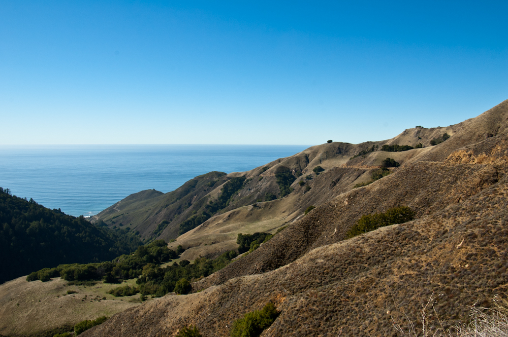
Nacimiento-Fergguson Road (NFR), high in Los Padres National Forest: After driving the dark, damp, forest floor, NFR begins its climb towards its summit at 2780 feet.  NFR is well paved and maintained, but is very winding and has precipitous drops at almost every turns.  There are no guard rails. The turn-off for Cone Peak Road, leads to some fantastic ocean sunsets.  However, Cone Peak Road may be closed due to weather from November to May.  The turn-off for Coast Ridge Trail, near the turn-off for Cone Peak Road, leads substantially parallel to the Pacific Ocean (i.e., north-south), along the crest of the range.

In October, 2009, the Mano Seca Group installed a bench near the top of the western slope of Nacimiento-Fergusson Road. A large turnout on the road provides easy parking; an opening in the roadside fence provides a path down to the bench.  The Mano Seca Group has a guerrilla reputation, as federal and state park services do not take kindly to the construction of unauthorized structures on park grounds.

Looking down one of the canyons from above the sea layer on NFR


Road cut for NFR clearly visible.


Road cut for NFR clearly visible.


Road cut for NFR clearly visible.


Road cut for NFR clearly visible as it circles the knob above the sea layer.


Burnt out trees contrasting with the high elevation greenery.


View across the Santa Lucia Range


Another view across the Santa Lucia Range


Road cut for NFR clearly visible along with the Pacific Ocean.

Sunday, December 2, 2012

Over the Mountains... (Part 5 of 7): Exiting Fort Hunter Liggett's back Entrance

by Steve Reiss (Dalmdad Landscape Photography - www.dalmdad.com and https://www.facebook.com/Dalmdad.)

Compared to the wide open space of FHL's Jolon gate,FHL's NFR gate is remote and tucked into the forest.  You may even--for a moment--feel bad for the guard posted here in the middle of no where.

This photo is courtesy Doctor Love 415


Nacimiento-Fergusson Road (NFR) is a popular highly-scenic, but tough to drive, Monterey County road.  As mentioned in an earlier post in this series, NFR begins at Mission Road in Fort Hunter Liggett near the truss bridge over the San Antonio River.  The Road ends 14 miles later at the Pacific Ocean, after twisting its way through the Los Padres National Forest and up and down the Santa Lucia Mountains.  Coast Road, which runs parallel to the Santa Lucia Range and the Pacific Ocean, crosses NFR about 9 miles from the NFR Gate of Fort Hunter Liggett. NFR is the only road that crosses the SL Range.

After the NFR gate, you are in pure forest country; trees, trees, and even more trees.  If you want to see fall in California, this is a good place to look.  A lot of visitors to California comment that we do not have a fall season.  That is not true, you just need to know where to look for it.  You won't find fall standing on the Newport Pier, where bikinis are worn year round or at the beach in San Clemente.

Scenes from fall in the Los Padres National Forest....


What people say about Nacimiento-Fergusson Road:

one of those roads that requires some serious planning to actually get to for most people.
***
If I never see Nacimiento-Fergusson road again, it will be too soon. Let me explain.,,,For the first few miles, the Nacimiento-Fergusson road was very nice. It took us through some fields, then we wound our way through the woods. But then, all of the sudden, we were climbing a cliff, the road got more narrow, and I lost my mind. I was shaking, driving 10 mile per hour, and basically behaving like a lunatic. They don't have mountains like that in Detroit! Fortunately, Margaret is a little cooler than I am and she ordered me to stop at a scenic viewing spot and she took over. We got a few pictures from this drive, but mostly, we were both completely freaked out. The road was too narrow for us to turn around, and it just kept getting scarier ahead. Eventually, however, we made it to the coast without Nacimientoing and we had one of the best breakfasts I've ever had.
*** 
 ***
***

Sunday, November 11, 2012

Over the Mountains... (Part 2 of 7): Visiting Fort Hunter Liggett

by Steve Reiss (Dalmdad Landscape Photography - www.dalmdad.com and https://www.facebook.com/Dalmdad.)

Disclaimer: This visit was in 2007...fort security procedures may have changed since then...

Jolon (see part 1 of this series) is the main gateway to Fort Hunter Liggett (FHL).  Indeed, technically, Jolon's few remaining structures are on ground owned by FHL, though outside the security gate.

FHL (named after General Hunter Liggett), is primarily used as a training facility, where activities such as field maneuvers and live fire exercises are performed (see part 4 of this series for more detail). 

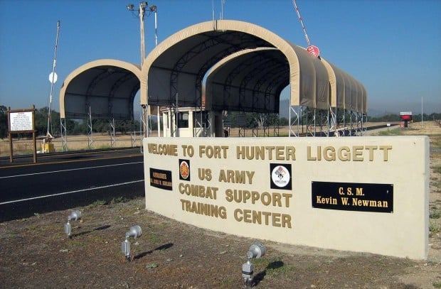
The fort is on land sold to the government by William Randolph Hearst in 1940, including  Jolon's ruins, and roughly midway between the northern and southern ends of Jolon Road.  The base is quiet and almost appears deserted unless training is going on.  You will need a driver’s license, insurance card, and vehicle registration to get through the Fort’s gate. Don't let the look of the main gate frighten you, security is a breeze (at least of the late 2000's).  The gate shown below was only added around 2005.


Picture of FHL's Jolon Main Gate (From Magicvalley.com)
On the fort grounds, there is a historic hotel known as The Hacienda (Milpitas Ranchhouse) which serves the general public and can be used as guest housing by military personnel. Julia Morgan, the designer of the hotel, designed over 700 buildings in California. Morgan's best known for her work on Hearst Castle in San Simeon, California


Although during the years I was exploring this area, I saw fairly good reviews of the Hacienda's food, I had never eaten there.  During an October, 2007 visit, which I am pretty sure was my last, I was ready to give the restaurant a try, but the restaurant portion was closed for business; though the hotel portion was openThe restaurant was still reportedly closed as recently as 2011.


Portion of Mission Revival Style Hacienda Hotel (including arched entries and arcade to the left)


Portion of Hacienda Hotel (detail)


Public Domain Panorama of Hacienda Hotel
With the restaurant closed, I wound up thinking I would not be eating lunch that day because of the limited services in the Jolon area. I continued exploring the base when the strong smell of a charcoal flame caught my nose.  A very simple and fairly priced hamburger, chips, and drink lunch combination was offered at the fort's bowling alley.  I ate out on a covered patio with a fantastic view of Junipero Serra Peak, Mission San Antonio (see part 3 of this series) and the rest of the Santa Lucia Mountains.


Lunch View of Junipero Sera Peak Rising Above Mission San Antonio
The fort is known for the herd of huntable deer and tule elk that roam the grounds, especially near the fence lines.  Here are some of them just hanging out and waiting to be cross-bowed or shot using non-lead ammunitionHunting and fishing rules and available target species are listed hereHere is a video about tule elk hunting on the fort.


***