Showing posts with label san antonio river. Show all posts

Sunday, November 25, 2012

Over the Mountains... (Part 4 of 7): Driving Through The Live Fire Range...

by Steve Reiss (Dalmdad Landscape Photography - www.dalmdad.com and https://www.facebook.com/Dalmdad.)

FHL has many live fire ranges.  One of the ranges is visible from the public Jolon Road, just north of the the Lockwood Store, south on Jolon Road from the fort's main gate. Inside the Lockwood Store there are pictures of Mel Gibson hanging on the wall from during the filming of We Were Soldiers (2002) at FHL.

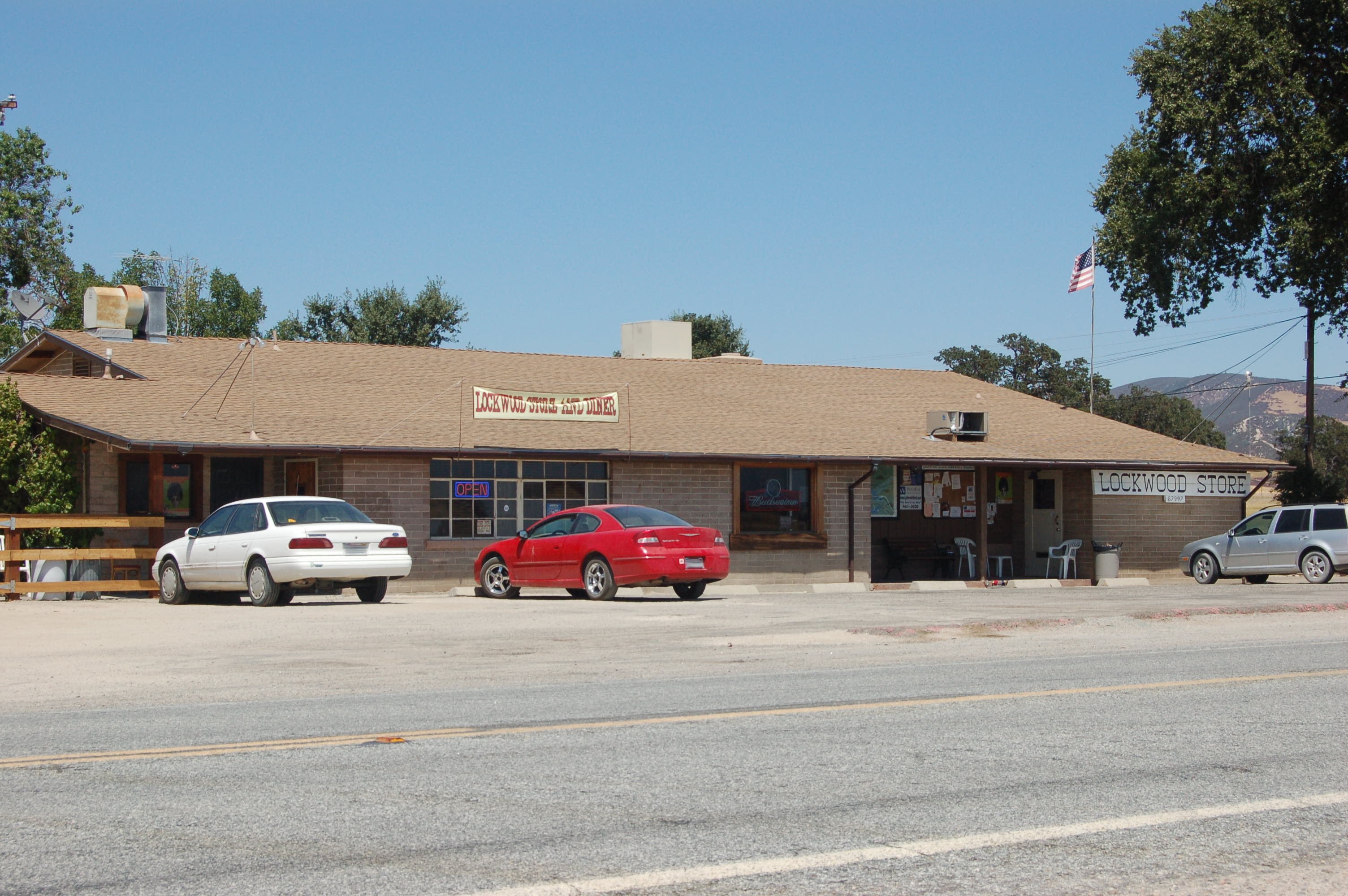
Lockwood Store: From http://chiefio.files.wordpress.com/

For whatever reason, I never took pictures of the Lockwood-area firing range, despite it being visible from the shoulder of Jolon Road.  However, you can see pictures of it here and below:
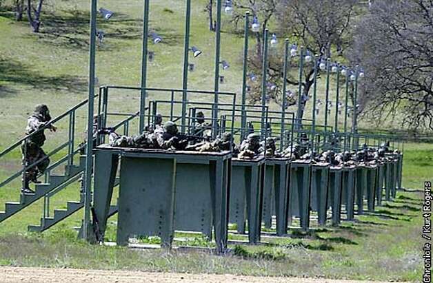

Photo From SFGate
Overhead view of Lockwood-area Firing Range

***
Back at the main part of the fort, closer to the Jolon main gate, you can drive directly through a live-fire area, when no live fire is going on.  From the main fort area and Mission Road, the main road through the fort, you turn to the west onto Nacimiento-Fergusson Road (more on NFR in a later post), which begins here.  Then, its over the simple truss bridge spanning the typically dry San Antonio River.


As can be seen on the map, you will curve through some heavy forest, loop around some hills and then reach the wide open Stoney Valley.


Here, the signs of the live fire range are obvious.


Videos of live-fire activities being carried out at FHL can be seen here, here, and here.
 
***

Sunday, November 4, 2012

Over the Mountain (Part 1 of 7): Visiting Jolon

by Steve Reiss (Dalmdad Landscape Photography - www.dalmdad.com and https://www.facebook.com/Dalmdad.)


From Steve Reiss, Travel Guide to Inland Monterey County, CA (2008), page 35:
Jolon and the San Antonio River Valley were critical to developing Monterey County
Jolon Road, once part of the original El Camino Real, was a major thoroughfare when the San Antonio River valley held most of Monterey County’s inland population. 

Jolon’s decline began in 1886 when railroad construction continued south down the Salinas Valley, beyond King City.  Jolon’s importance further declined in 1918, when the portion of the El Camino Real passing through Jolon was rerouted through the Salinas Valley and built up into the four-lane US101


Describing Jolon today as a “town” is somewhat generous because part of Jolon burned to the ground in 1929 and another portion of Jolon was demolished by the Army in the 1940’s.  All that remains of Jolon are:  St. Luke's Church, the abandoned Tidball Store, and the ruins of the Dutton Hotel.


Building US101 through the Salinas River Valley ended the traditional custom of routing travelers through commercial centers and towards businesses.  While US101 bypassed only the commercial areas of Bradley and San Ardo, Jolon was completely bypassed.
***
Juxtaposing what was, with what remains...

Page 37, from Travel Guide To Inland Monterey County, CA

***
Windmill seen in historical picture next to Tidball Store - still stands


Historical Marker for Dutton Hotel
Entrance to Rancho Jolon


Preparing for Halloween (October 2007)


Vinyards near Jolon (October 2007)


Old bus stop shelter on Jolon Road


Looking out the window, from inside the bus shelter
árbol muy verde

Jolon Road crossing creek near junction with US101 south of King City, CA.

***