Showing posts with label kingman. Show all posts

Thursday, October 31, 2013

Halloween Tales in The Nevada and California Deserts

by Steve Reiss (Dalmdad Landscape Photography - www.dalmdad.com and https://www.facebook.com/Dalmdad.)

I am not a big fan of Halloween.  I really lost my taste for Halloween, sometime after I was "egged" while walking home from Eric Brand's place to my own.  However, we at Dalmdad Landscape Photography try to "give the people what they want".  So, here are links to two Halloween stories: 

First, last year we have reported on:The Ghost Bus, The Finger and Phalli on an Arizona Highway.   This story has been repeated by chroniclers of strange Mojave Desert days and ways.  The story is not original to us.  However, next time you are in Laughlin watching the baccarat table and see a player with diabolical red eyes going all in, wonder if the player has the forces of evil on his side.

Second, we have presented a story inspired by deaths or ash spreadings known to occur near the Kwaaymii Overlook. Kwaaymii Mysteries is an entirely fictional tale, inspired by actual events the occur at the Overlook.

We hope you enjoy....
***

Monday, December 17, 2012

Outragous Gas Prices in Needles, CA

by Steve Reiss (Dalmdad Landscape Photography - www.dalmdad.com and https://www.facebook.com/Dalmdad.)

Sunday, November 7, 2004: Needles, CA: I was driving cross-country to California for the first time. It had been about 4 days since I left Memphis, TN.  I had passed through Arkansas, Oklahoma, the Texas panhandle, New Mexico, and Arizona; so far, about 1500 miles.  I spent last night in Kingman, AZ.

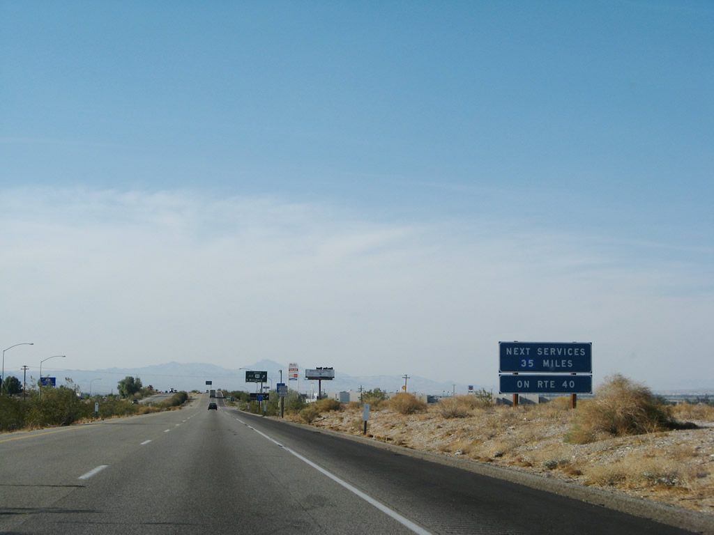
After breakfast in Kingman, I headed west on the I-40.  Not knowing any better, I stopped in Needles, CA, that morning for the same reason most people stop there and have stopped there since the Dust Bowl years of the 1930s. Needles is the first major population center in California (current population 5600, 1930's population 3100) after the long, desolate, 60 mile drive west on I-40 from Kingman, AZ (and US66 prior to the construction of I-40) and the last reasonably populated place along I-40 before the scarey "No Services Next 35 Miles" sign.

I don't reme
mber how much gas cost on that Sunday in 2004, when I stopped for a fill-up in Needles, but I seem to remember that the gas price was
absurdly expensive.  The emotional shock of spending so much on gas that morning left a long-time negative taste in my mouth concerning Needles. 

***

Now, many years later, I am a much more seasoned traveler.  I have learned, like many of the residents of, and visitors to, Needles (see here, here, here) themselves, to purposely drive the few extra miles to avoid having to gas up in Needles and make it to Mohave Valley or Bullhead City, Arizona where gas is historically about 40 cents to a dollar a gallon cheaper.  The gas price situation in Needles is so crazy, that in September, 2012, when I asked my friend in Needles how much gas was there, she did not know.  She told me the gas price in Bullhead City, AZ and said add a dollar and that is probably what it is in Needles.

This is when I began to fully appreciate the immediate personal and economic impact that CA state and county gas taxes, coupled with Needles' unique position on the I-40 between Barstow, CA, and Kingman, AZ, create the opportunity for, or at least the appearance of, price gouging. 

Historical differences in gas prices between Needles, California, and the rest of the US can be seen in photos of Needles' gas stations' price boards posted on Flickr over the years. 


CA Gas price data from here
US Gas price data from here 
 
Date Needles CA US
5/8/2005 3.09 2.56 2.23
5/26/2006
3.79 3.32 2.89
6/14/2006 3.89 3.22 2.91
12/28/2006 3.29 2.61 2.34
1/4/2007 3.89 2.61 2.33
4/2/2007 3.79 3.23 2.71
3/24/2008 4.09 3.60 3.26
5/21/2008 4.69 3.95 3.79
6/15/2008 5.19 4.58 4.08
9/25/2008 4.59 3.73 3.72
11/15/2008 3.29 2.37 2.07


Where exactly is Needles?  It is on the California side of the Colorado River and a historic stop along US66 (now I-40).  Before the I-15 and its predecessor highway (US91/466) where built, those driving from Vegas to LA had to take the US95 (gray line) from Vegas to Needles to catch the US66/I-40.


Needles Locator Map


Wednesday, October 31, 2012

The Ghost Bus, The Finger and Phalli on an Arizona Highway

by Steve Reiss (Dalmdad Landscape Photography - www.dalmdad.com and https://www.facebook.com/Dalmdad.)

Outside Bullhead City, AZ: Union Pass is the highpoint on highway AZ68 as the road passes through the Black Mountains between the flatness of the Colorado River valley at Laughlin, NV/Bullhead City, AZ and the flatness of Golden Valley outside of Kingman, AZ. The Union Pass area is reportedly on the route of a haunted bus carrying 48 elderly gamblers ridiculously insistent upon making it from Phoenix to the Laughlin, NV casinos and that disappeared in the area in the early 1990's. The story first appeared in a blog entry by Jim Cook (the self-proclaimed 'Official State Liar of Arizona') at wickenberg-az.com, on October 27, 2003.

The original Cook version of the ghost bus story, long and twisted, says:
...
Bus 777 groaned onto I-40, rolled through Kingman, and found its way to Arizona 68, going west toward Laughlin. This was the home stretch. Impatient passengers began getting ready to exit the bus and make a break for the casinos, which were still a good 30 minutes away.
As the bus climbed the grade toward Union Pass, it really began losing power. Union Pass is a gateway through the Black Mountains, named for members of the Union Of Pioneer Pass Builders, who completed it in 1851.
Once through the pass, Arizona 68 swoops down to the Colorado River and the bridge to Laughlin. Joe [the driver] was having a hard time coaxing the bus the last few hundred yards to the summit of Union Pass.
Finally, he pulled onto the shoulder and told the passengers, “This is it, folks. The bus won’t go anymore.”
The passengers mutinied. Joe remembers Danny advancing on him, a malevolent look on his face. Danny’s eyes were slits of hot coals, and his pointed ears had turned red.
Joe remembers standing dazed beside the road as passengers pushed bus 777 over Union Pass and clambered aboard as it started down the west side, out of his view. The passengers had taken his shoes.
A tourist from Iowa, driving up toward Union Pass from the river, said he saw the bus speeding down the grade toward him. It went around a curve where a small hill hid it from view–and it never emerged.
When he got to the place where he should have met the bus, there was nothing–no bus, no skid marks, no debris, nothing.
That was the last sighting of bus 777 in this world. Lawmen combed the arroyos along Arizona 68 for days, but not so much as a skid mark or piece of chrome was ever found.
Another -more dramatic... and embellished- version of the ghost bus story appeared in 2010 at a website dedicated to UFO and Paranormal News, and included melodramatic detail:
Through a mire of heat, Joe recognized his bus, Number 777, now being pushed uphill by a gaggle of demons resembling his most recent passengers. At the helm of the vehicle was the old man-turned-Devil who had led the mutiny. An evil smile gracing his black lips, the senior citizen-cum-incubus glared back at the bus driver.
It was then Joe noticed the "icing on the cake." Those blue-haired bastards had stolen his shoes. Barefoot and confused, the coach operator watched as the troupe of fiends pushed the deceased bus to the crest of Union Pass.
 And of the bus,, also called the "Grim Weeper", the 2010 story reported that:
The vehicular apparition appears suddenly in your rear-view mirror, headlights ablaze, purportedly weeping molten chrome. Without warning, the behemoth devours your car, as you fight to retain sanity. Clearing your front bumper, the beast dissolves into the roadway illuminated by your headlights. The vacant seats inside your automobile become inexplicably occupied by ghostly passengers. Before you've wrangled your car to the side of the road, your otherworldly travel companions have vanished. You're left along the shoulder of a darkened highway, in the middle of nowhere, wondering if that signpost up ahead reads, "The Twilight Zone."

<< -  to Bullhead City ---------------------------------- to Kingman ->>

***
AZ 68 curves its way through and passes ...depending on the tilt of your imagination...a variety of provocatively shaped rock formations as it travels through the Black Mountain's Union Pass.  The Black Mountains are not actually black, nor are they actually mountains.  Well, ok, they actually are mountains.  The Black Mountain Range is of volcanic origin and runs 75 miles north-south just east of the Colorado River and peak out at Mount Perkins (5456 ft).  The Black Mountains are frequently seen rising above the green waters of the Colorado River.  Quiet little Oatman, AZ, the "free range burro" capitol of the world, is nestled up at about 2710 ft. on old US66 in a Black Mountain pass.  The "needles formation", which give the town of Needles, CA, its name, are not part of the Black Mountain Range; rather, they are part of the Mohave Mountain Range.
AZ68 Climbing Union Pass From the West


"The Finger" in the Distance
A first rock formation, first seen from quite a bit away, gives so-inclined viewers the impression of the exposed middle finger.  The flipped filthy finger flash becomes even more pointed at you as the road closes in on the rock formation.

As you get real close, you have an opportunity for a second impression.  It does not take a PHD in Geology or abstract art, to see nature flipping you off as you drive buy. Yes, Mother Nature is calling you a Mother $%#&.  The formation is called "Thumb Butte" on the Davis Dam 1:100,000 Quad Topographic Map of 1982.
"The Finger" of AZ68 Up Close

Thumb Butte from an entirely different angle with better lighting

***
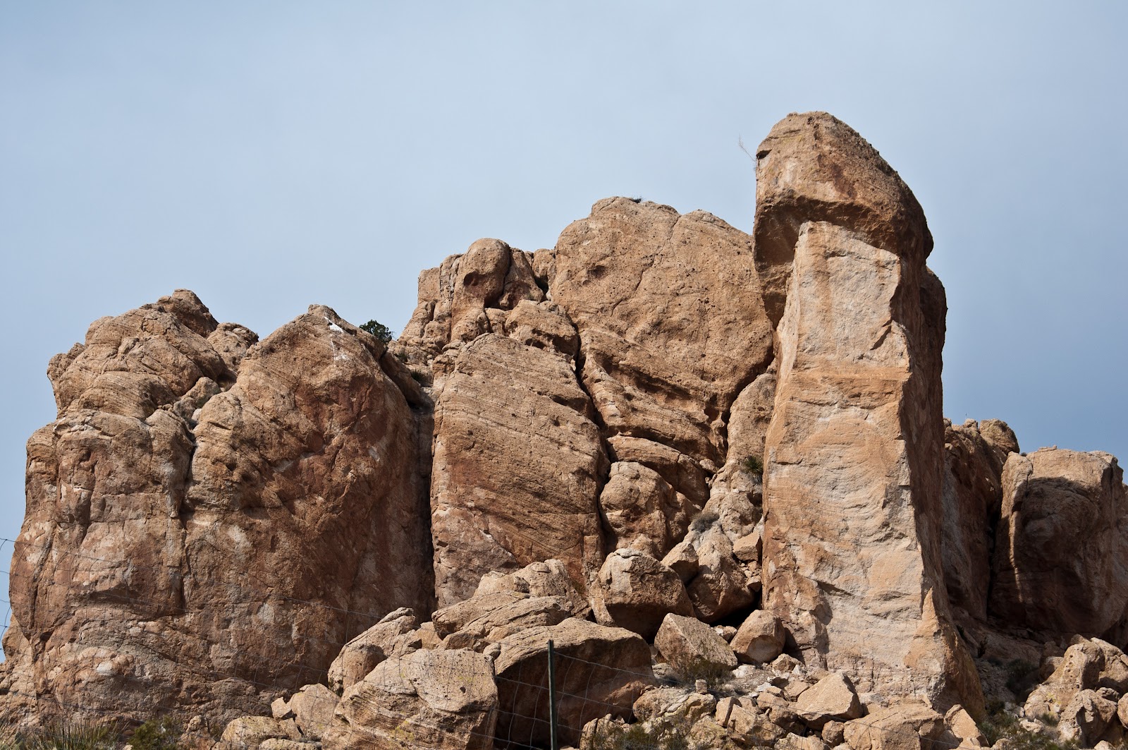
A second rock formation right along the shoulder of the highway has an even more perverse appearance.

Even before I took the picture of this second formation, I certainly had a "naughty" subject in mind.  When I posted the picture on Flickr, I gave the picture the intriguing, but tame (or lame?), title of "Interesting?"  I did not give the picture any overtly suggestive or explicit title or id tags.  I don't want my Fickr stream labelled anything other than safe.  However, that did not stop someone else from taking a more explicit approach.


An "interesting" looking rock formation on AZ68

Not long (actually very shortly) after my version of the picture was posted to Flickr., someone outside my Flickr network saw the picture, tagged it "circumcision", and added it to her group "Circumcision."  The someone goes under the name "I wasn't circumcised - Lucky being a girl." 


***
All this action on a 27 mile strip of highway...