Sunday, December 2, 2012

Humming and Buzzing Times on Catalina Island

by Steve Reiss (Dalmdad Landscape Photography - www.dalmdad.com and https://www.facebook.com/Dalmdad.)

November 23, 2012: Catalina Island, CA: Our tour bus driver was able to get the truck started and  running again. this time for more than 5 minutes, to begin tracking down the members of our tour that split out in search of a usable cell signal. Remarkably, the tour company did not provide its driver with a guaranteed form of communication with their base of operations, such as a two way radio or satellite phone.  Cell phone service is intermittent out in some of the more remote parts of the island.  Its not like no one had a clue of what was going on out in the outback areas of the island.

Our Hummer refusing to start some where near the eastern edge of the island, far from Avalon


We ultimately make it to Catalina Airport, also known as the Airport in the Sky.

 
Stopping at the Airport

At the airport terminal, there is a snack bar with a covered eating area.  While we were there, there was a lot of hummingbird and bumble bee action.


***

Sunday, November 25, 2012

Over the Mountains... (Part 4 of 7): Driving Through The Live Fire Range...

by Steve Reiss (Dalmdad Landscape Photography - www.dalmdad.com and https://www.facebook.com/Dalmdad.)

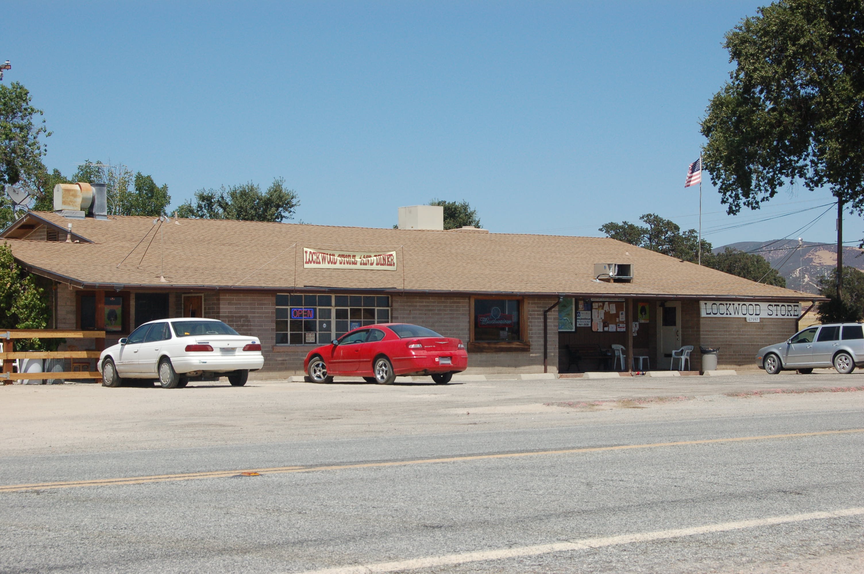
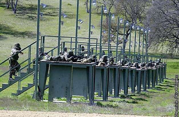
FHL has many live fire ranges.  One of the ranges is visible from the public Jolon Road, just north of the the Lockwood Store, south on Jolon Road from the fort's main gate. Inside the Lockwood Store there are pictures of Mel Gibson hanging on the wall from during the filming of We Were Soldiers (2002) at FHL.

Lockwood Store: From http://chiefio.files.wordpress.com/

For whatever reason, I never took pictures of the Lockwood-area firing range, despite it being visible from the shoulder of Jolon Road.  However, you can see pictures of it here and below:


Photo From SFGate
Overhead view of Lockwood-area Firing Range

***
Back at the main part of the fort, closer to the Jolon main gate, you can drive directly through a live-fire area, when no live fire is going on.  From the main fort area and Mission Road, the main road through the fort, you turn to the west onto Nacimiento-Fergusson Road (more on NFR in a later post), which begins here.  Then, its over the simple truss bridge spanning the typically dry San Antonio River.


As can be seen on the map, you will curve through some heavy forest, loop around some hills and then reach the wide open Stoney Valley.


Here, the signs of the live fire range are obvious.


Videos of live-fire activities being carried out at FHL can be seen here, here, and here.
 
***

Sunday, November 18, 2012

Over the Mountains... (Part 3 of 7): Visiting Mission San Antonio...

by Steve Reiss (Dalmdad Landscape Photography - www.dalmdad.com and https://www.facebook.com/Dalmdad.)


Mission San Antonio and Santa Lucia Mountains

Mission San Antonio de Padua (Mission San Antonio) (3rd Mission – 1771) is on the grounds of Fort Hunter Liggett (FHL) (see our descriptions of FHL here and here).  The mission is about 6 miles from the fort's main gate down Mission Road. The only earlier missions of the Alta California Spanish Mission system are: Mission San Diego de Alcala (Mission San Diego) (1st Mission - 1769) and Mission San Carlos Borromeo de Carmelo (Mission Carmel) (2nd mission - 1770).  There are 21 missions in California.  During World War II, there was a class of fleet oiler ships with each ship named after one of the California Missions.  Key facts about Mission San Antonio can be found here.

By 1774, there were 178 Salinan Indians living on the mission grounds and two years later, in 1776, that number increased to 500.  By 1805, there were 1300, though after secularaziation in 1834, the number fell to 150. 

What was secularization?
After Mexico won its independence from Spain, it found that it could no longer afford to keep the missions running as Spain had done. In 1834, Mexico decided to end the mission system and sell all of the lands. They offered the lands to the Indians who did not want the lands or could not come up with the purchase price. The lands were divided into smaller Ranchos and sold to Mexican citizens who were helpful during the war for independence. In 1845, Governor Pio Pico declared Mission buildings for sale and no one even bid for San Antonio. After nearly 30 years, the missions were returned to the Catholic Church. Although some of the missions had already been returned to the church, in 1863, President Abraham Lincoln signed an Act declaring that all of the 21 missions in the California mission chain would become the property of the Catholic Church and have remained so since that time.

The first Catholic wedding to take place in California occurred at Mission San Antonio in 1773 between a Salinan Indian woman named Margaretta de Cortona and Spanish solider Juan Maria Ruiz.

By 1827, the mission had 7,362 cattle, 11,000 sheep, 500 mares and colts and 300 horses.

***

"...a thing to see up the road at Mission San Antonio was the herds of golden horses, descended from the mare of Anza's soldier Juan Palomino."  From Riesenberg, The Golden Road: The Story of California's Mission Trail (1962).
***

Despite its substantial distance and remoteness from Watsonville, where we were living at the time, we visited this mission quite soon after our move to California.  Exciting was to see this warning:


Rattler Warning!
But still no sightings


Also, while using the bathroom, you could hear, but not see, critters playing in the ceiling beams.  Animal burrow holes are all over the grounds.


Burrow Holes

The mission, reconstructed from 1928-1978, includes the main sanctuary, the Padre's Garden, a couple of out buildings and the parish priest's home (modern).  At the time we visited, the priest has some very barky dogs kept behind a wooden privacy fence.  A large desert tortoise named Timone was free to roam the grounds.  Timone was the first desert tortoise we ever saw and I snapped tons of pictures of the critter and use them as stock photos whenever the need for a desert tortoise photo arises.  I recently heard from the mission administrator (November, 2012) that the tortoise has been gone for around six years.

 
Timone - Parish Desert Tortoise
Main Building - Outer Views


Campanario (bell tower/wall) With Arched Entrance to Main Church


Close-up of bell and bell-hole in campanario
Wide view from plaza of campanario and arched outside corridor
Arched outside corridor detail
Cross
Main Church - Inner Views


Seasonal Display with view of sanctuary and alter looking down nave


Detail of seasonal display


Prayer Candles
Raised Pulpit with entrance from outside sanctuary

Padre's Garden Views


in sepia


Sun-dial showing about noon.


Someone needs to clean out the fountain


Parish Black Cat


Wood Panel painting inspired by California state flag


Wide View in Padre's Garden
Grist Mill with Mill-race


Race leading to grist mill with cross in upper left
(The cross was was erected by the Army in 1976 as part of a US bicentennial celebration and honoring the original DeAnza party that had come through the area 200 years before on their way to settling San Francisco.)
Grist Mill viewed from below
Grist Mill close up


Description of Mayordomo House Ruins


Cobblestone Foundation of Mayordomo House

Miscellaneous
Fired-clay tile stacks
Mission San Antonio was the first California mission to have a clay-fired roof


Wood door with Adobe Walls


Can't be in California and not have at least one barred window!